Mount Index/East Route
A challenging scramble with 5,500 feet of elevation gain. This route traverses around Lake Serene with Mount Index cliffs towering above, then ascends a steep gully through the cliffs to the summit.
getting there
Drive US-2 to Milepost 35.2, turn south onto Mount Index Road, and then drive 0.3 miles to the Lake Serene & Bridal Veil Falls Trailhead (600 ft).
approach & ascent
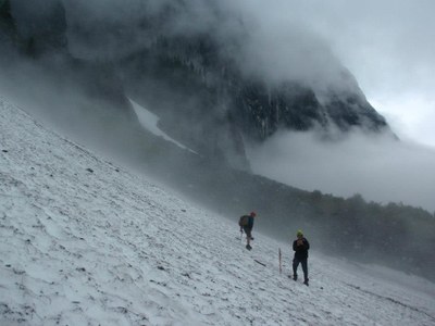
Follow the easy Lake Serene trail for 4.1 miles and 2000 feet of elevation gain to the north end of Lake Serene and the end of the trail. Traverse around the west side of the lake over talus and huge boulders to the south end of the lake, the snow is not as steep closer to the water. Hopefully all of these boulders are covered in snow to make travel easier.
From the south end of the lake head east to the saddle and then up the ridge heading southwest from the saddle. The brush is extremely thick between 3,000 ft and 3,600 ft, so go early season when it's covered in snow. At 3,500 feet there's a rock face (40 vertical feet) with large cracks and ledges and it can't be avoided. It's a lot easier to ascend, so for the descent most groups will probably want a rope just in case.
Stay on the ridge until it ends then head south and go under/around the first outcropping at 4,200 ft. Then head west up the gully which steepens near the top. There's a tiny waterfall at 4,800 ft and it's impassable in the summer, so having snow in this gully is required. Climb up the gully until it flattens out, then continue northwest to the summit.
descent
Descend the same route. Make sure to head down the same gully that you ascended. Some have had trouble here, so it may be good to bring a wand to mark the location.
NOTES
- Go early season (typically May or June) when there's still snow in the gully at the tiny waterfall, and also when snow covers the 600 vertical feet of brush on the south side of Lake Serene which is extremely thick and soul crushing.
- Plan for a very long day, easily 15+ hours. To maximize daylight for the technical section of the trip, plan to use headlamps in the morning to get to Lake Serene and start the traverse around the lake as sunrise begins. That should allow enough time for the summit and the descent back to the north end of Lake Serene before sunset.
- Suitable Activities: Scrambling
- Seasons: April, May, June
- Weather: View weather forecast
- Difficulty: Technical 5, Strenuous 5
- Length: 13.0 mi
- Elevation Gain: 5,500 ft
- 5,991 ft
-
Land Manager:
Mount Baker-Snoqualmie National Forest
Skykomish Ranger District (MBSNF)
- Parking Permit Required: Northwest Forest Pass
- Recommended Party Size: 12
- Maximum Party Size: 12
- Maximum Route/Place Capacity: 12
- USGS Index
- Green Trails Index No. 142
- Green Trails Alpine Lakes West (Stevens Pass) No. 176S
There are no resources for this route/place. Log in and send us updates, images, or resources.
