
Mount Howard & Mount Mastiff
These two peaks, located on the north side of Highway 2 east of Stevens Pass, can be scrambled separately or combined. When combined, it's a scramble of 13 miles with 5,500 feet of elevation gain.
Getting There
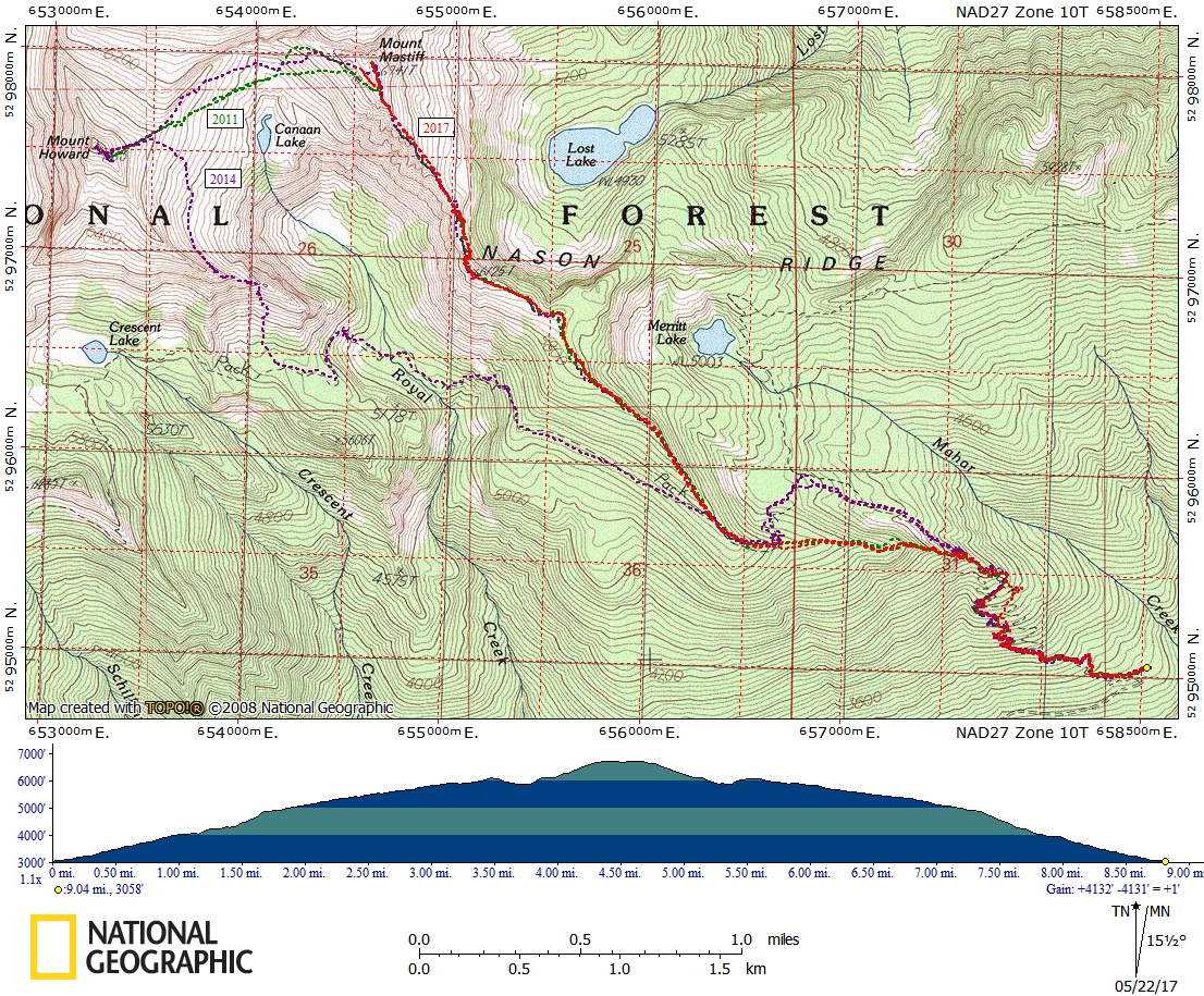
Drive SR 2 to Forest Road 657. Drive up ~1.5 miles to the end of the road and the Merritt Lake trailhead (3,050 ft).
approach & ascent
Mount Howard (7,063 ft)
Starting and ending at the Merritt Lake trailhead, it's 12 miles round trip with 4,900 feet of elevation gain. The difficulty is Strenuous 4 | Technical 2.
Mount Mastiff (6,741 ft)
Starting and ending at the Merritt Lake trailhead, it's 10 miles round trip with 3,330 feet of elevation gain. The difficulty is Strenuous 3 | Technical 3.
Mastiff & Howard LOOP
Starting and ending at the Merritt Lake trailhead, it's 13 miles round trip with 5,200 feet of elevation gain. The difficulty is Strenuous 5 | Technical 3.
Mastiff & Howard: Nason Ridge Traverse
Starting at Merritt Lake trailhead and finishing at Rock Mountain trailhead (with a car shuttle between the trailheads), it’s 14.5 miles round trip with 5,500 feet of elevation gain. The difficulty is Strenuous 5 | Technical 3.
- Suitable Activities: Scrambling
- Seasons: June, July, August, September
- Weather: View weather forecast
- Difficulty: Technical 3, Strenuous 5
- Length: 13.0 mi
- Elevation Gain: 5,500 ft
- 6,741 ft
- Land Manager: Okanogan-Wenatchee National Forests
- Parking Permit Required: Northwest Forest Pass
- Recommended Party Size: 12
- Maximum Party Size: 12
- Maximum Route/Place Capacity: 12
- Green Trails Alpine Lakes East (Stuart Range) No. 208SX
- USGS Mt Howard
- Green Trails Wenatchee Lake No. 145
- Green Trails Alpine Lakes West (Stevens Pass) No. 176S
This is a list of titles that represent the variations of trips you can take at this route/place. This includes side trips, extensions and peak combinations. Not seeing a title that fits your trip? Log in and send us updates, images, or resources.
- Mount Howard
- Mount Mastiff
- Mount Mastiff & Mount Howard Loop
- Mount Mastiff & Mount Howard: Nason Ridge Traverse