Mount Hardy/South Face
A short, steep scramble near Washington Pass in the North Cascades. It's 4.5 miles and 4,100 feet of elevation gain.
getting there
Drive SR 20 to ~2 miles west of Rainy Pass and park on the widened shoulder just east of swamp creek.
approach & ascent
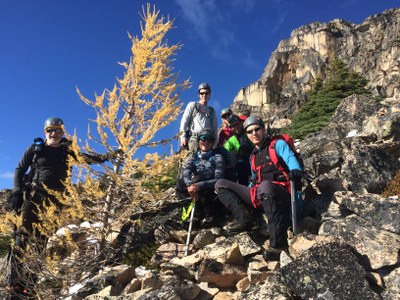
Hike west along SR 20 over swamp creek. Leave the road west of swamp creek and hike north/northeast to gain the prominent ridge on the south side of the mountain. There is a very faint boot path that may difficult to follow. It is best to scramble climber's right to avoid cliff bands at 5,200 ft but otherwise keep to the ridge where possible. Leave the ridge at about 7,200 ft and scramble loose scree and blocks on the east side (climber's right) of the ridge to a notch below the summit block. Cross the notch and scramble a shallow gully to the summit. Descend the climbing route.
notes
- The USGS Washington Pass map labels a point (7,197 ft) to the north and west as the summit while other resources such as SummitPost and Peakbagger label the highest point of the ridge (8,080 ft to 8,120 t) as the true summit of Mount Hardy.
- Suitable Activities: Scrambling
- Seasons: July, August, September, October
- Weather: View weather forecast
- View avalanche forecast.
- Difficulty: Strenuous 4, Technical 5
- Length: 4.5 mi
- Elevation Gain: 4,100 ft
- 8,100 ft
- Land Manager: North Cascades National Park
- Parking Permit Required: None
- Recommended Party Size: 12
- Maximum Party Size: 12
- Maximum Route/Place Capacity: 12
- USGS Mt Arriva
- Trails Illustrated North Cascades National Park
- Green Trails Mt Logan No. 49
- Green Trails Washington Pass No. 50
There are no resources for this route/place. Log in and send us updates, images, or resources.
