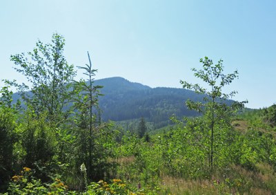
McDonald Mountain
A great hike along old logging roads with wonderful views, 9 mi and 2,300 ft of elevation gain. It's only 20 mi east of Kent and 7 mi east of Maple Valley.
Getting There
Take the Kent-Kangley east from Covington. Stay on it past SR-169 in Maple Valley. Six miles beyond that intersection the road will hit a sign saying that the road ends in 2 miles.
Just beyond that sign you will see a Blue Washington Department of Natural Resources (DNR) gate to the right. Park here, this is the trailhead. There is minimal space for parking, maybe 5 or 6 cars worth on the right side of the road.
On the trail
The path follows logging road switchbacks and is largely unimproved until about 1,500 ft and 2 mi when up you enter the first big clearcut. Here there are great views to Rattlesnake Ledge, Mount Teneriffe and the summit of Mount Si.
On the other side of the clearcut, the logging road you are walking on merges briefly with a larger road and shortly after seems to split off into three. It is actually one gated road on the left, one road in the middle and the entrance to a clearing on the right. Take the middle blue gate.
The route to the radio tower angles up to the right. At 4.2 mi you will reach the radio tower. This is not the true summit, but has good views. Continuing up the logging road a short distance to a small ledge down some steps cut into the bank to the right of the road to a small ledge with an amazing view of Mount Rainier and more on a clear day.
INFORMATION FOR LEADERS
- Permits are required in this area for all fee-based (course-related) activities, regardless of group size. Leaders may list trips at this route/place with the understanding that they need to verify that a permit has been obtained before running the trip (if required as outlined above). Permit applications are submitted to WA Department of Natural Resources annually in December. Please contact info@mountaineers.org with any additional questions. More details about permitting on WA DNR land as it applies to Mountaineers trips, as well as our current year Land Use License, can be found here.
- Suitable Activities: Day Hiking
- Seasons: April, May, June, July, August, September, October, November
- Weather: View weather forecast
- Difficulty: Moderate
- Length: 8.8 None
- Elevation Gain: 2,340 ft
- 3,300 ft
- Land Manager: Washington State Department of Natural Resources
- Parking Permit Required: Discover Pass
- Recommended Party Size: 12
- Maximum Party Size: 12
- Maximum Route/Place Capacity: 12
- USGS Eagle Gorge
- USGS Cumberland
There are no resources for this route/place. Log in and send us updates, images, or resources.
