Little Ranger Peak
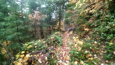
A moderate, 10 mile hike with just over 2,400 feet of elevation gain. This trail travels through a forest of vine maples, big-leaf maples and alders. The summit opens up with a view of Mount Rainier and the mountains of the White River Valley.
getting there
From Enumclaw, drive east 28 miles on SR-410. Turn right Forest Road 7160, cross the White River and park in the Skookum Flats parking area (2,400 ft).
on the trail
Little Ranger Peak
10 miles round trip with 2,450 feet of elevation gain, 5,120 ft high point
This trail travels through a forest of vine maples, big-leaf maples and alders. The summit opens up with a view of Mount Rainier and the mountains of the White River Valley.
Little Ranger Overlook
6 miles round trip with 1,000 feet of elevation gain, 3,670 Ft High Point
This hike follows the same trail as Little Ranger Peak through a forest of vine maples, big-leaf maples and alders but stops at Little Ranger Overlook which is a rocky outcropping that offers views of the White River Valley.
- Suitable Activities: Day Hiking
- Seasons: June, July, August, September, October
- Weather: View weather forecast
- Difficulty: Moderate
- Length: 10.0 mi
- Elevation Gain: 2,450 ft
- 5,120 ft
-
Land Manager:
Mount Baker-Snoqualmie National Forest
Snoqualmie Ranger District (MBSNF)
- Parking Permit Required: Northwest Forest Pass
- Recommended Party Size: 12
- Maximum Party Size: 12
- Maximum Route/Place Capacity: 12
- Green Trails Greenwater No. 238
- USGS Sun Top
This is a list of titles that represent the variations of trips you can take at this route/place. This includes side trips, extensions and peak combinations. Not seeing a title that fits your trip? Log in and send us updates, images, or resources.
- Ranger Creek
- Ranger Creek Shelter
- Little Ranger Peak & Ranger Creek Shelter
- Little Ranger Overlook
There are no resources for this route/place. Log in and send us updates, images, or resources.
