Jester Mountain
The highest point along Teanaway Ridge, this route is mostly on trail with a short scramble at the end. It's 7.4 miles and 1,950 feet of elevation gain. Enjoy views of the many Teanaweay area peaks.
driving directions
From US 97, drive Forest Road 9714 to its end and the Iron Bear trailhead (3,700 ft).
approach & ascent
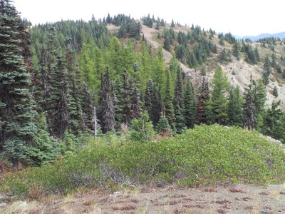
Hike the Iron Bear Trail (No. 1351) up through the trees nearly two miles to a four-way junction on Teanaway Ridge. Take the Teanaway Ridge Trail (No. 1364) to the right and follow the ridge north. The trail switchbacks a few times before reaching a false summit called Iron Bear Peak (5,489 ft). The views on the false summit are good but to reach the highest point, continue along the trail to the north. The trail fades into non-maintained boot path as you approach the summit (5,520 ft). A hike in the summer when the snow has melted but a scramble when snow covered.
Notes
- Combine Jester Mountain with a more mellow hike to the central highpoint of Teanaway Ridge for a longer hike and a good workout.
- There are upper and lower parking areas. Smaller cars (lower clearance) should use the lower parking area, because the end of the road near the upper parking area is rough.
- Suitable Activities: Day Hiking, Scrambling
- Seasons: June, July, August, September, October, November
- Weather: View weather forecast
- View avalanche forecast.
- Difficulty: Strenuous 3, Technical 2
- Length: 7.4 mi
- Elevation Gain: 1,950 ft
- 5,520 ft
-
Land Manager:
Okanogan-Wenatchee National Forests
Cle Elum Ranger District (OWNF)
- Parking Permit Required: Northwest Forest Pass
- Recommended Party Size: 12
- Maximum Party Size: 12
- Maximum Route/Place Capacity: 12
- Green Trails Alpine Lakes East (Stuart Range) No. 208SX
- Green Trails Liberty No. 210
- USGS Liberty
There are no resources for this route/place. Log in and send us updates, images, or resources.
