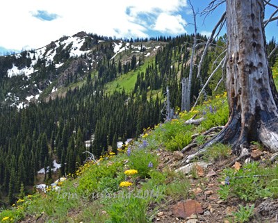
Highchair & Bootjack Mountains
Highchair Mountain & Bootjack Mountain is a scramble of 12 miles with 5,400 feet of elevation gain.
Getting There
Drive US-2 to Leavenworth and turn east onto Icicle Creek Road at the west end of town. Drive ~18 miles to near the road's end at the parking area immediately north of Black Pine Campground (2,820 ft).
approach & ascent
Bootjack Mountain (6,789 ft)
7.5 miles round trip, 3,900 feet of elevation gain
difficulty: Strenuous 4, Technical 2
Hike the Jackpine Trail, No. 1597 across the road from the parking area, for 0.2 mile as it jogs south, and then east to a the junction with Blackjack Ridge Trail, No. 1565. Follow the Blackjack Ridge Trail generally south for 2.5 miles until 5,800 ft, at which point it emerges from the forest into an old burn and veers southeast. At 6,100 ft, leave the trail (which goes downhill) and follow a bootpath south & uphill, through a gap in the trees, then along the east side of the ridge to Bootjack Mountain's summit block. The summit block offers several short scramble pitches ranging in difficulty from Technical 2 to Technical 4.
Bootjack Mountain (6,789 ft) & Highchair Mountain (7,016 ft)
11.2 miles round trip, 5,200 feet of elevation gain
Difficulty: Strenuous 5, Technical 3
Beyond Bootjack Mountain’s summit, it is off-trail travel, with only faint vestiges of a bootpath. From its summit, descend south through a saddle and climb to just east of the top of Point 6640. Traverse westward another 1.2 miles on the ridge crest, sometimes dropping slightly to the south side, to the low point of the ridge at 6,180 ft. From the low point, following a bearing of 238° (south of the ridge) for 0.15 mile to reach The Oasis, a shallow tarn and the only water source on the route (coordinates: 10T 651688 5270432, dry in late summer). From The Oasis, follow a bearing of 254° up through larch trees and excellent-quality knobby orange boulders to re-gain the ridge at 6,750 ft. Continue up the left side of the ridge to the Highchair Mountain summit.
Notes
- This route would also work well in early season, with the usual caveat to exercise caution regarding avalanche and cornice hazards. However, the boulder-strewn ridge south of Bootjack becomes a minefield during the transition from solid snow cover to bare rock, and should be avoided during that time.
- Suitable Activities: Scrambling
- Seasons: June, July, August, September, October
- Weather: View weather forecast
- Difficulty: *Varies*, Strenuous 4, Strenuous 5, Technical 2, Technical 3, Technical 4
- Length: 13.0 mi
- Elevation Gain: 5,600 ft
- 7,016 ft
-
Land Manager:
Okanogan-Wenatchee National Forests
Alpine Lakes Wilderness, Cle Elum Ranger District (OWNF)
- Parking Permit Required: Northwest Forest Pass
- Recommended Party Size: 12
- Maximum Party Size: 12
- Maximum Route/Place Capacity: 12
- USGS Jack Ridge
- Green Trails Chiwaukum Mtns No. 177
- Green Trails Alpine Lakes West (Stevens Pass) No. 176S
This is a list of titles that represent the variations of trips you can take at this route/place. This includes side trips, extensions and peak combinations. Not seeing a title that fits your trip? Log in and send us updates, images, or resources.
- Bootjack Mountain
- Highchair Mountain
- Bootjack Mountain & Highchair Mountain
There are no resources for this route/place. Log in and send us updates, images, or resources.
