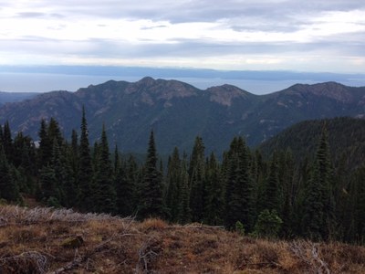
Happy Lake Ridge–Olympic Hot Springs Loop
A beautiful and strenuous loop trip with sweeping views of the Elwha River Valley and Mount Olympus, as well as a visit to Boulder Lake. For those interested, includes a well deserved soak in Olympic Hot Springs at the end of the day.
getting there
The Olympic Hot Springs Road leaves US-101 approximately 8.6 miles west of Port Angeles. Follow the Olympic Hot Springs Road south to reach the poorly marked Happy Lake Ridge Trail (8.6 miles, 1,750 ft). While traveling this road south you should bear right at 0.2 miles to avoid the Little River Road, and bear straight ahead at 4.0 miles to avoid the Whiskey Bend Road. To avoid a 1.5 mile road walk at the end of this loop trip, parties might want to stage a car at the end of the Olympic Hot Springs Road before returning in another car to this trailhead.
NOTE: Because of a washout, the Olympic Hot Springs Road is closed. Park at Madison Falls and bike or hike 6.5 mile one-way to the Happy Lake Trailhead.
on the trail
Happy Lake Ridge Trail
From the parking area (0.0 mi, 1,750 ft) follow the Happy Lake Ridge Trail uphill to reach the ridge crest (3.0 mi, 4,500 ft). Continue following the trail in a westerly direction as it meanders a bit below the crest on its north side until passing through a low spot (5.0 mi, 5,300 ft) in another ridge that runs north to south. Shortly after this low spot is a junction with a way trail to the northwest that can be followed for 0.5mi to reach Happy Lake (4,875 ft). Resuming from this junction, continue following the Happy Lake Ridge Trail to the west to reach a junction with the Aurora Divide Trail (7.5 mi, 5,000 ft).
The Aurora Divide Trail can be hiked for 1.0 mi to the north, followed by 0.5 mi of cross country travel to reach the summit of Lizard Head Peak (5,350 ft). For parties visiting Lizard Head Peak it is suggested to traverse at ~5,000 ft on its south side until just southwest of the summit, then follow game trails to the top to avoid scrub trees and rock scrambling on the narrow ridge crest west of the summit.
Resuming from the Happy Lake Ridge Trail—Aurora Divide Trai junction (7.5 mi, 5,000 ft), continue following the Happy Lake Ridge Trail along the ridge crest in a southwesterly direction before beginning the descent (9.5mi, 4,925ft) towards a junction with the Boulder Lake Trail (10.0 mi, 4,400 ft), just north of Boulder Lake.
boulder lake & olympic hot springs
From Boulder Lake descend from the Boulder Lake Trail junction (10.0 mi, 4,400 ft) to reach the junction with the Appleton Pass Trail (12.7 mi, 2,350 ft). From this junction you descend in an easterly direction to pass through Olympic Hot Springs (13.5 mi, 2,061 ft) and maybe even enjoy a well deserved soak. Hike along a portion of the Olympic Hot Springs Road that is closed to vehicles to finally complete the loop and reach the Olympic Hot Springs Trail parking area (16.0 mi, 1,800 ft). If you opted to visit Happy Lake (an extra mile) as well as Lizard Head Peak (an extra 3 miles) the total distance for this loop is 20 miles. If you opted to not leave a car at this trailhead you have another 1.5 miles of walking along the road to reach the Happy Lake Ridge trailhead.
notes
- Many guidebooks refer to this hike starting on pavement. The park has removed the pavement on the trail.
- The Lake Mills Dam has also been removed, an incredible site in and of itself.
- Suitable Activities: Backpacking, Day Hiking, Scrambling
- Snowshoeing Category: Intermediate
- Seasons: June, July, August, September, October
- Weather: View weather forecast
- Difficulty: *Varies*, Easy, Moderate, Strenuous
- Length: 20.0 mi
- Elevation Gain: 4,700 ft
- 5,350 ft
- Land Manager: Olympic National Park
- Parking Permit Required: National Park Entrance Fee
- Recommended Party Size: 12
- Maximum Party Size: 12
- Maximum Route/Place Capacity: 12
- Green Trails Seven Lakes Basin/Mt Olympus Climb No. 133S
- Custom Correct Seven Lakes Basin - Hoh
- Custom Correct Lake Crescent - Happy Lake Ridge
There are no resources for this route/place. Log in and send us updates, images, or resources.
