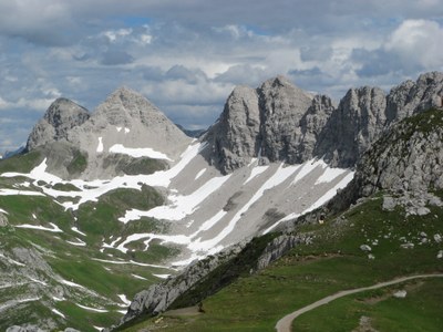
Hike the Alps of Western Austria
Hiking in the high country of western Austria, in the northern limestone Alps of Lech and in the Silvretta and Rätikon Alps of the Montafon and Paznaun valleys, offers wonderful hiking and spectacular views, from high mountain meadows to rugged hiker passes, from mountain huts to scenic, 3500-meter Piz Buin. Enjoy comfortable accommodations and tasty food in the evenings.
Little-known outside of Europe, the Lech and the Montafon valley areas are located in the westernmost Austrian Province of Vorarlberg, and near to the Province of Tirol. They are popular for winter skiing, but they also offer scenic mountain vistas and superb hiking opportunities to the summer visitor.
The Lech area lies north, near the German border, at an elevation of 4700 feet. The town is surrounded by peaks and ridges of limestone that rise abruptly from green hillsides and high lakes. A network of trails accesses the beautiful countryside, and an excellent bus system easily conveys hikers to the many trailheads.
Farther south, near the Swiss border, are the towns of Schruns in the Montafon valley and Galtür in the Paznaun valley. They provide accommodations and easy access to the Silvretta and Rätikon mountain ranges. The Rätikon is a rampart of vertical limestone that is almost completely ice-free. The neighboring Silvretta Alps are the more scenically dramatic range, where green meadows contrast with bold, ice-clad peaks, a land that calls to a walker. At least 40 Silvretta mountains exceed 3000 meters (9800 feet). And just to the north is the Verwall range, with additional hiking opportunities.
Alpine villages, spectacular views of glaciers and mysterious peaks, and mountain huts and inns set high above the valleys await you. Hundreds of miles of trails are easily accessed by the extensive transportation system of buses, trains and cablecars. Multi-day treks can be done by linking together several trail segments with stays in the high-mountain huts.
- Suitable Activities: Global Adventures, Day Hiking, Backpacking
- Seasons: June, July, August, September
- Weather: View weather forecast
- Difficulty: Moderate/Strenuous, Strenuous
- 11,480 ft
- Land Manager: Land Manager Varies
- Parking Permit Required: see Land Manager
- Recommended Party Size: 12
- Maximum Party Size: 12
- Maximum Route/Place Capacity: 12
There are no resources for this route/place. Log in and send us updates, images, or resources.
