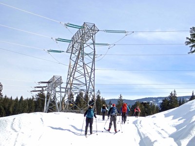
Crystal Springs Dog Sled Trails
Ski up to 10 miles on dog sled trails with modest elevation gain from the Crystal Springs Sno-Park. It is a winter wonderland of trails suitable for intermediate cross-country skiers.
Getting There
Take Exit 62 off of I-90, turn right and continue to the Crystal Springs Sno-Park.
On the Trail
Dog Sled Trails
up to 10 miles and 500 ft of elevation gain
Access the trails from the west end of the Crystal Springs Sno-Park. There is a winter grooming schedule, but classic tracks are not cut on these trails. Access to some of the trails shares the mixed use Palouse to Cascades State Park Trail (aka John Wayne Trail and Iron Horse Trail) east of Stampede Pass Road that allows snowmobiles. One section shares the road to our Meany Lodge that may have some weekend snowmobile and cat traffic. Snowmobilers are asked to keep off these trails, but there is no guarantee. Also, these are dog sled trails, so there are likely to be some dog droppings along the route to avoid. There are a number of interesting and picturesque loops that allow for ski tours up to 10 miles and 500 ft of elevation gain.
Meadow Creek Lollipop
15-mile loop with 1,800 feet of elevation gain
This uses a combo of the groomed dog sled, Palouse to Cascades, and snowmobile trails for a demanding 16 mile loop from the Crystal Springs Sno-Park. Some sections of the groomed for snowmobiles are only intermittently groomed. So we might need to break track between the Lost Lake junction and the Meadow Creek divide (3 miles). Traversing the route counter clockwise allows skiers to ascend the possibly ungroomed and steepest hill section and then glide down the long descent from Meadow Creek Divide back to the Palouse to Cascades Trail, a 5-mile, 1600-foot descent. Because of snowmobile usage this route is best enjoyed on non-holiday weekdays.
notes
- Visit the Washington State Parks Blewett/I-90 Sno-Park web page for info about the Crystal Springs Sno-Park and maps of the dog sled and snowmobile trails.
- The dog sled trails are best suited for intermediate classic skiers and when there is new snow backcountry skis can be an advantage.
- When recently groomed the dog sled trail are suitable for skate skiers.
Information for Leaders
Scheduling & Permits
- If you are scheduling this as a non-course related activity, please limit your group size to the recommended party size. The maximum party size is for use by course field trips only, and includes both students and instructors. Group size maximums do not reflect how course field trips are run (in smaller groups of students and instructors), but allow for course leaders to register the course in our system.
- If you are scheduling a course field trip, please contact our Member Services Team to confirm the field trip and any permitting regulations.
- Suitable Activities: Cross-country Skiing
- Seasons: January, February, March
- Weather: View weather forecast
- Difficulty: U-XC 2 Advanced Beginner Ungroomed, U-XC 3 Intermediate Ungroomed
- Length: 10.0 mi
- Elevation Gain: 500 ft
- 3,000 ft
-
Land Manager:
Okanogan-Wenatchee National Forests
Cle Elum Ranger District (OWNF)
- Parking Permit Required: SnoPark Pass
- Recommended Party Size: 12
- Maximum Party Size: 20
- Maximum Route/Place Capacity: 20
- Green Trails Snoqualmie Pass No. 207
- see Notes
This is a list of titles that represent the variations of trips you can take at this route/place. This includes side trips, extensions and peak combinations. Not seeing a title that fits your trip? Log in and send us updates, images, or resources.
- Meadow Creek Loop
| Name/Description |
|---|
| Meadow Creek Loop "Ride with GPS" Map A topo map for the Meadow Creek Loop from the Crystal Spring Sno-Park created in "Ride with GPS" maps by Randy Oakley, January 2021. |
| Meadow Creek Loop "Gaia GPS" Map A topo map for the Meadow Creek Loop from the Crystal Spring Sno-Park created in "Gaia GPS" maps by Randy Oakley, January 2021. |
