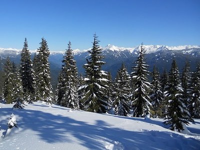
Cow Heaven & Helen Buttes
Cow Heaven is a strenuous snowshoe hike with 4,000 ft in elevation gain over 5 miles one way. The trail follows a creek up through forests and steep switchbacks. Scramble the southern ridge from Cow Heaven to reach Helen Buttes.
getting there
Drive SR 20 (North Cascades Highway) to just west of Marblemount. Turn north onto Ranger Station Road and then right onto Olson Creek Road in 0.7 mi. In 0.3 mi, arrive at the trailhead (400 ft).
approach & ascent
Cow Heaven
Travel the route of Cow Heaven Trail. It does not follow a distinct ridge or valley, so be confident in your navigation and route-finding abilities. It's 10 miles round trip with 4,000 feet of elevation gain to a high point of 4,400 ft.
helen buttes
Follow the Cow Heaven Trail to about 4,000 ft, then take the southern ridge to the summit. There is some steep rock. The summit is on the border of the Noisy-Diobsud Wilderness. It's 12 miles round trip with 5,200 feet of elevation gain to a high point of 5,520 ft.
- Suitable Activities: Scrambling, Snowshoeing
- Snowshoeing Category: Intermediate
- Seasons: January, February, March, December
- Weather: View weather forecast
- View avalanche forecast.
- Difficulty: Strenuous, Winter Scramble
- Length: 12.0 mi
- Elevation Gain: 5,200 ft
- 5,520 ft
-
Land Manager:
Mount Baker-Snoqualmie National Forest
Mount Baker Ranger District (MBSNF)
- Parking Permit Required: Northwest Forest Pass
- Recommended Party Size: 12
- Maximum Party Size: 12
- Maximum Route/Place Capacity: 12
- USGS Marblemount
- USGS Sauk Mountain
- Green Trails Marblemount No. 47
- Trails Illustrated North Cascades National Park
This is a list of titles that represent the variations of trips you can take at this route/place. This includes side trips, extensions and peak combinations. Not seeing a title that fits your trip? Log in and send us updates, images, or resources.
- Cow Heaven
- Cow Heaven (winter)
- Helen Buttes
- Helen Buttes (winter)
- Cow Heaven & Helen Buttes (winter)
There are no resources for this route/place. Log in and send us updates, images, or resources.
