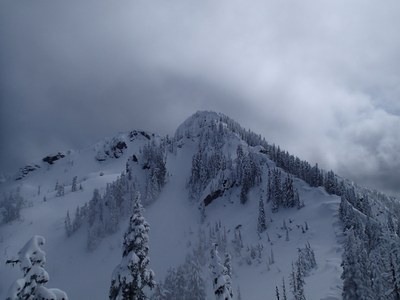
Copper Mountain/East Ridge (Olympics)
A moderate, 8 mile scramble with 2,800 feet elevation gain. This scramble will take you along a historical trail and up the seldom-climbed east side of Copper Mountain.
getting there
From US-101 in Hoodsport, turn west onto SR-119 (North Lake Cushman Road) and drive 9.4 miles to a T intersection. Turn right on Forest Road 24 and in 1.5 miles, turn left on Forest Road 2419. Continue on Forest Road 2419 for 6.2 miles (1.8 miles past the lower trailhead), turn left onto Forest Road 2419-014, and continue 1 mile to the Mount Ellinor upper trailhead (3,500 ft).
Approach
Beginning at the upper Mount Ellinor trailhead hike the old road bed west to intersect with the lower Mount Ellinor trail. Follow the lower trail up a short distance and turn west onto a historical trail leading toward Mount Rose. At Bear Camp, head northwest on an abandoned trail, crossing over the Rose-Elizabeth ridge, and continue northerly to the trail end at a large fir blow down. Turn right and ascend slope 100 feet to ridge, then descend to the 4,040+ foot saddle east of Copper Mountain looking north into the Hamma Hamma River watershed (some brush).
Ascent Route
From the saddle ascend westerly in open timber and some brush (cedar) until above timberline (about an hour from the saddle). Continue up the East Ridge on heather, rock and scree or snow slopes to just below the east summit of Copper. Scramble over and down rock step (Class 2, 10 feet high), then climb through and over cedar and other brush for 20 feet (some may want a fixed line) to open ridge. Continue toward the gap between the east peak and west peak (true summit), avoiding the more difficult gap area by descending 300 feet to the south on scree and heather, then making an ascending traverse to the ridge crest at the notch. This is the notch reached from Wagonwheel Lake on the standard route. From the notch, scramble up wide ledges and steps to the summit (Class 2).
Notes
- Take rope for a short fixed line across the exposed ridge line near the east summit. The scramble is easier without snow. In a normal spring or early summer season, there may be cornices and some slopes are steep with poor run out.
- Suitable Activities: Scrambling
- Seasons: May, June, July, August, September, October
- Weather: View weather forecast
- Difficulty: Technical 3, Strenuous 3
- Length: 8.0 mi
- Elevation Gain: 2,800 ft
- 5,425 ft
-
Land Manager:
Olympic National Forest
Mount Skokomish Wilderness, Hood Canal Ranger District (ONF)
- Parking Permit Required: Northwest Forest Pass
- Recommended Party Size: 12
- Maximum Party Size: 12
- Maximum Route/Place Capacity: 12
- USGS Mt Skokomish
- Green Trails Olympic Mountains East No. 168S
- Green Trails Mt Steel No. 167
- Custom Correct Mount Skokomish - Lake Cushman
This is a list of titles that represent the variations of trips you can take at this route/place. This includes side trips, extensions and peak combinations. Not seeing a title that fits your trip? Log in and send us updates, images, or resources.
- Copper Mountain/East Ridge
There are no resources for this route/place. Log in and send us updates, images, or resources.
