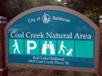
Coal Creek Natural Area
An easy, 6 mile urban hike with 500 ft in elevation gain. Walk through a canopy of second growth forest in Coal Creek Nature Area to adjoining Cougar Mountain Regional Wildland Park.
Starting June 16, 2025 the Red Cedar Trailhead will be closed for multiple years, due to construction activity by King County. Please visit King County's project website to learn more.
getting there
Take Exit 10 off of I-405 and drive 1.2 miles east on Coal Creek Parkway. At the bottom of the hill, the parking area in on the left, across from a "No Left Turn" sign. Drive until you can around and approach from the south to enter the Red Cedar Trailhead (200 ft).
notes
- The east side of The Coal Creek Natural Area is served by the Red Town Trailhead and our Coal Creek route/place.
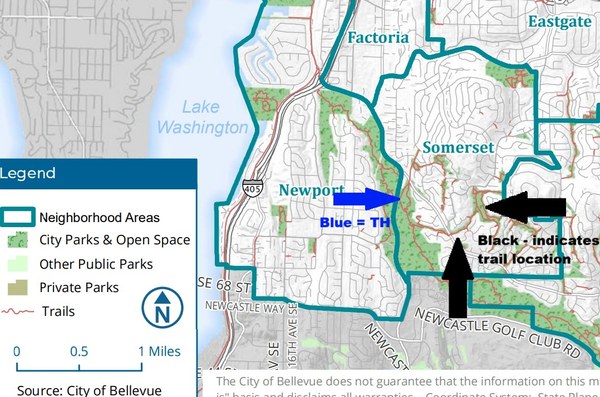
- From the Red Cedar TH of the Coal Creek Natural Area, trails within Bellevue Open Space can also be accessed. See image/attachment 1. This image is taken from "Bellevue Parks and Open Space
System Plan 2022" (https://bellevuewa.gov/sites/default/files/media/pdf_document/2023/Parks-Open-Space-System-Plan-2022.pdf), see pages 158 and 186. The image is provided only as FYI so that you know to which trails this refers to.
- Suitable Activities: Day Hiking, Naturalist, Trail Running, Urban Walking
- Seasons: Year-round
- Weather: View weather forecast
- Difficulty: Easy
- Length: 6.0 mi
- Elevation Gain: 500 ft
- 640 ft
- Land Manager: Bellevue Parks & Community Services
- Parking Permit Required: None
- Recommended Party Size: 12
- Maximum Party Size: 12
- Maximum Route/Place Capacity: 12
- Green Trails Cougar Mtn No. 203S
This is a list of titles that represent the variations of trips you can take at this route/place. This includes side trips, extensions and peak combinations. Not seeing a title that fits your trip? Log in and send us updates, images, or resources.
- Coal Creek Trail
- Coal Creek Trail - Cinder Mine TH
- Coal Creek Trail - Red Cedar TH
- Bellevue Open Space trails
There are no resources for this route/place. Log in and send us updates, images, or resources.

