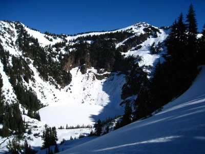
Breccia Peak
A moderately strenuous scramble along the Mountain Loop Highway, usually done as a spring or early summer snow scramble.
driving directions
From Darrington, drive 19.7 mi south on the Mountain Loop Highway and trun left onto Sloan Creek Road (Forest Road 49). Drive 3.5 mi to the Lost Creek Ridge Trailhead (1,849 ft).
approach & ascent
Hike the Lost Creek Ridge Trail over Bingley Gap (4,400 ft), and then east to 5,500 ft (just south of Sunup Lake). Depart the trail, go around the shore of Sunup Lake, and ascend to the saddle northeast of Sunup Lake (6,240 ft). Follow ridge north to the summit (6,487 ft), which is not identified by name on USGS map.
- Suitable Activities: Scrambling
- Seasons: April, May, June, July
- Weather: View weather forecast
- View avalanche forecast.
- Difficulty: Strenuous 4, Technical 2
- Length: 12.0 mi
- Elevation Gain: 4,600 ft
- 6,487 ft
-
Land Manager:
Mount Baker-Snoqualmie National Forest
Darrington Ranger District (MBSNF)
- Parking Permit Required: Northwest Forest Pass
- Recommended Party Size: 12
- Maximum Party Size: 12
- Maximum Route/Place Capacity: 12
- USGS Sloan Peak
- USGS Pugh Mountain
- Green Trails Mountain Loop Highway No. 111SX
There are no resources for this route/place. Log in and send us updates, images, or resources.
