Trip
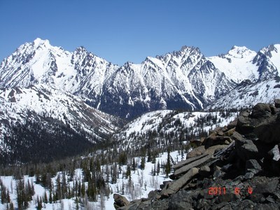
Day Hike - Navaho Pass
11 miles, 3000', 1.75 MPH average moving speed. Fall colors, lots of views, and a some golden larches.
- Tue, Oct 3, 2023
- Foothills Hiking Committee
- Day Hiking
- Adults
- Strenuous
- Challenging
- Mileage: 11.0 mi
- Elevation Gain: 3,000 ft
- Pace: 1.75 MPH average moving speed
- 7 (11 capacity)
- Cancellation & Refund Policy
8:00 AM at what google maps calls the 'Navaho Pass Trailhead', use google maps and this location https://goo.gl/maps/CZiPtbPd2FYKvmwk9
One carpooling option is the East Sunset Way trailhead at 6:15, right off of i-90, exit 18. google maps location https://goo.gl/maps/djkvEqoc7boULQXr7
Route/Place
Navaho Pass & Peak
-
Green Trails Alpine Lakes East (Stuart Range) No. 208SX
Green Trails Mt Stuart No. 209
USGS Red Top Mtn
USGS Enchantment Lakes - See full route/place details.
Roster
Required Equipment
Required Equipment
- Navigation
- Headlamp
- Sun protection
- First aid
- Knife
- Fire
- Shelter
- Extra food
- Extra water
- Extra clothes
Trip Reports
