Trip
Day Hike - Longs Pass & Iron Peak Loop
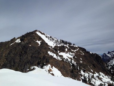
13 miles, 5000', Iron Peak, Beverly and Ingalls Creek, Long's Pass, mountain views, larches, and lots of fall colors on this large loop. The route is in yellow https://caltopo.com/m/5V9U0
- Sat, Sep 30, 2023
- Foothills Hiking Committee
- Day Hiking
- Adults
- Strenuous
- Challenging
- Mileage: 13.0 mi
- Elevation Gain: 5,000 ft
- Pace: 2 MPH average moving speed
- 12 (11 capacity)
- Cancellation & Refund Policy
We will meet at the Iron Peak trailhead at 7:45. https://goo.gl/maps/hrQrPGr65DE2haX19 please park perpendicular to the road (most of the area has plenty of room to do that and we can fit more cars in).
I need someone to pick me up at East Sunset Way trailhead at 5:45. It is 200 feet off of I-90 (exit 18).
From the top of Iron Peak, to the base of Mt. Stuart on Ingalls Creek, to Longs Pass, the views are outstanding! This trip is dependent on decent weather (no downpours).
Iron & Teanaway Peaks
-
Green Trails Alpine Lakes East (Stuart Range) No. 208SX
Green Trails Mt Stuart No. 209
USGS Mount Stuart - See full route/place details.
Required Equipment
- Navigation
- Headlamp
- Sun protection
- First aid
- Knife
- Fire
- Shelter
- Extra food
- Extra water
- Extra clothes
