Trip
Day Hike - Black Canyon (Umtanum Ridge)
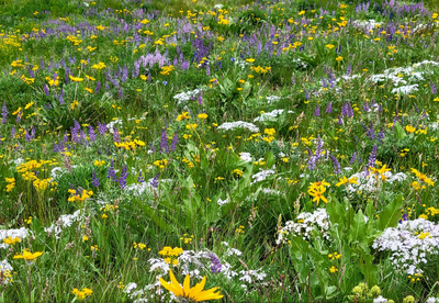
We'll go up Black Canyon, traverse Umtanum ridge off-trail for 2 miles looking down at thick fields of flowers, loop back down to the other arm of Black Canyon through thick flowers, and return to the starting point.
- Sat, Jun 3, 2023
- Foothills Hiking Committee
- Day Hiking
- Adults
- Strenuous
- Challenging
- Mileage: 12.0 mi
- Elevation Gain: 2,700 ft
- Pace: 1.75 MPH average moving speed
- 1 (11 capacity)
- Cancellation & Refund Policy
8:30 at the trailhead, use google maps and this link https://goo.gl/maps/vUberGVRfE4wQcKs9 or use these coordinates 46.834736, -120.712615
1 carpooling option is east sunset way trailhead in Issaquah at 6:00 https://goo.gl/maps/wHcf4qPVzz4NMRW47 I need at least 1 person to be willing to pick me up there, I need a ride
A detailed trip report with photos and video, we should see something like this https://www.wta.org/go-hiking/trip-reports/trip_report-2022-06-10-5127370395
The route https://caltopo.com/m/FM5FD
Black Canyon (Umtanum Ridge)
-
WA DNR Yakima
USGS Manastash Creek
USGS Wenas Lake - See full route/place details.
Required Equipment
- Navigation
- Headlamp
- Sun protection
- First aid
- Knife
- Fire
- Shelter
- Extra food
- Extra water
- Extra clothes
