Trip
Backpack - Olympic Coast North: The Shipwreck Coast
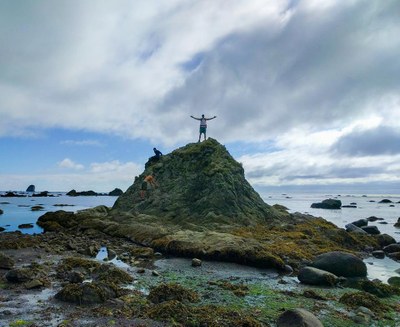
Spend the weekend gawking at sea stacks on the breathtaking Olympic coast! On Saturday 3 miles of boardwalk and 3 miles of beach brings us to our campsite at Yellow Banks with only 350 feet of elevation gain. On Sunday we’ll head 6 miles north to the westernmost point in the continental United States and then it’s 3 miles of boardwalk back to the trailhead. While open to all Mountaineers, this trip is designed to provide extra skills practice to B3 students
- Sat, Jul 28, 2018 — Sun, Jul 29, 2018
- Foothills Backpacking Committee
- Backpacking
- Adults
- Strenuous
- Easy
- Mileage: 15.0 mi
- Elevation Gain: 350 ft
- High Point Elevation: 175 ft
- Pace: 1 to 1.5 mph
- FULL, 2 on waitlist (5 capacity)
- Cancellation & Refund Policy
Olympic National Park Wilderness Information Center at 9AM
Address:
3002 Mt Angeles Rd, Port Angeles, WA 98362
Difficulty: the "route" that is attached to this trip is the entire 20+ mile stretch of coast from Ozette to Rialto. However, we are only doing the nice sandy parts at the northern end and avoiding the more unpleasant bits. This is why the route difficulty is "strenuous" but my rating is "easy".
Bear canisters are required on the coast because of raccoons, they can be rented from REI or checked out from the ranger station if they have any available. See the following for more information:
https://www.nps.gov/olym/planyourvisit/wilderness-food-storage.htm
Tides:
Immediately before our campsite there is a headland (rocky point) which is impassible when the tides are above 5 feet. This means that we will not be able to reach our campsite until after 5PM on Saturday, which is fine since it will take us about that long to reach it anyway. Tides will not be an issue on Sunday.
For more information see the following shortened link to the NOAA tides website:
National Weather Service point forecast:
https://forecast.weather.gov/MapClick.php?lon=-124.68337&lat=48.09669#.W1k4FdJKiUk
Hourly forecast:
https://goo.gl/jXndp2
Rough itinerary:
Saturday:
9:00 Meet at Wilderness Information Center to obtain permit and any additional bear canisters
9:30 - 10-ish (depending on lines) Drive to Ozette Ranger Station (76 miles, ~2 hours)
Noon: Start hiking towards Sand Point (3 miles)
3:00 Arrive at the beach, start hiking south towards Yellow Banks (3 miles)
6:00 Arrive at camp
8:58 Sunset
Sunday:
5:56 Sunrise
7:00 Hike north to Cape Alava and Tskawahyah Island (the westernmost point of the continental United States), stopping to check out the Wedding Rocks along the way (6 miles)
2:00 Hike back to the trailhead (3 miles)
5:00 Arrive at cars
Note that this itinerary assumes a worst-case scenario of traveling 1 mph. If weather is awful we have the option to skip Cape Alava and return to the cars on the same trail we came in on, which would cut Sunday's distance by 3 miles. Also don't forget to factor in additional driving/ferry time.
Speaking of ferries, on Saturday if you catch the 7:10AM ferry from Edmonds to Kingston you'll arrive in Kingston at 7:40AM and it's a 1 hour and 20 minute drive to the Wilderness Information Center, meaning you'll arrive almost exactly at 9AM. This is the ferry I plan to take. Also keep in mind that 7:10 is the departure time - I usually arrive at the ferry terminal about 20 minutes before that.
Olympic Coast North: The Shipwreck Coast
-
Custom Correct North Olympic Coast
Green Trails Ozette No. 130S
Trails Illustrated Olympic National Park
Green Trails Olympic Coast Beaches No. 99S - See full route/place details.
Required Equipment
The Ten Essentials plus overnight gear which may include:
- Tent with footprint/ground tarp
- Stove and fuel
- Sleeping bag
- Sleeping pad
- Water filter
- Bear canister
- Cooking pot/pan with plate and utensils
- Toilet paper and shovel or blue bag to deal with waste
