Field trip: Conditioning Hiking Series
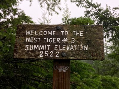
CHS 2 Hike - West Tiger Mountain 1, 2 & 3
Hike to all 4 of the West Tiger summits! Enjoy a good workout and views of the Issaquah lowlands from the top. CHS 2 hike led at a pace of 2.0-3.0 mph.
- Sat, May 8, 2021
- Seattle Hiking Committee
- Day Hiking
- Adults
- Strenuous
- Challenging
- Mileage: 9.6 mi
- Elevation Gain: 2,830 ft
- Pace: 2.0-3.0 mph
- 1 (7 capacity)
- Cancellation & Refund Policy
We'll meet at 7:30 am at the High Point trailhead on Tiger Mountain. The group will depart from the trailhead at 7:45 am.
Directions
From Seattle, drive east on I-90 to exit 20 (High Point Way). At the end of the off ramp make a 180 degree right turn onto a frontage road that turns from pavement to gravel about halfway to the trailhead. There is a large parking lot not too far up the road.
A Discover pass is required to park at the trailhead.
There is a pit toilet at the trailhead.
5/8/21 Hike
The trail is mostly shady in this densely grown forest. We will “summit” the 4 West Tiger Mountain “peaks” hiking a loop on a sequence of many different trails. Tiger Peak # 2 is the second tallest peak in the Tigers at 2948 ft and will be our highest point for the day. There will be steep sections as well as more gentle uphills/downhills. Consider bringing hiking poles to use for the steep Section Line segment.
If we’re at Poo Poo Point at the right time – we may see paragliders launching from the steep face of Poo Poo Point.
We plan to stop for a lunch break in an open area (out of the woods) between West Tiger 1 and West Tiger 2.
Weather Forecast
https://forecast.weather.gov/MapClick.php?lat=47.53010000000006&lon=-122.03438999999997
COVID-19
Please remember to follow all of the required COVID protocols. You must have the required face covering (mask, neck gaiter, bandana) and hand sanitizer in your possession to participate in this hike. The face covering must be able to cover the mouth and nose when we pass close to others. Be prepared to step off the trail or turn outward when passing other hikers and maintain social distancing. Carpooling is limited to household members.
Fun Facts
Tiger Mountain is a ridge located in the western foothills of the Washington Cascades, just east of Seattle. Tiger’s main ridge runs WNW/ESE about 6 miles, with summits being (from east to west) Tiger Mountain (3004), West Tiger 1 (2948), West Tiger 2 (2757) and West Tiger 3, (2557). There are two summits to the south of the main ridge, Middle Tiger (2607) and South Tiger (2028).
Tiger Mountain is probably the most heavily used 2000 vertical feet of hiking in the state, being a favorite conditioning hike for Seattle metro area climbers.
It is not known exactly how Tiger Mountain got its name but it may be named for someone named "Tiger". Although, it has also been reported that the name derives from the fact that "Cougar Mountain" already had that name and "wild cat", "puma", "mountain lion" and "bob cat" weren't nearly as cool sounding. Cougars are occasionally seen on Tiger Mountain.
Wildlife on Tiger is reasonably abundant. Deer, raccoons, squirrels, chipmunks, owls, frogs, lizards, and many types of birds are seen and/or heard. Bears are occasionally sighted.
Required Equipment
Ten Essential Systems
- Navigation (map & compass)
- Sun protection (sunglasses & sunscreen)
- Insulation (extra clothing)
- Illumination (headlamp/flashlight)
- First-aid supplies
- Fire (waterproof matches/lighter/candle)
- Repair kit and tools
- Nutrition (extra food)
- Hydration (extra water)
- Emergency shelter (tent/plastic tube tent/garbage bag)
