Field trip: Conditioning Hiking Series
CHS 2 Hike - May Valley Loop (Squak Mountain)
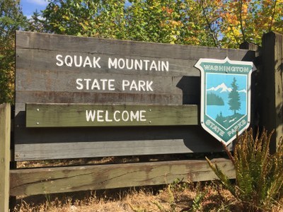
A loop hike starting from the May Valley trailhead at the south end of Squak Mountain State Park.
- Sat, Apr 17, 2021
- Seattle Hiking Committee
- Day Hiking
- Adults
- Moderate
- Moderate
- Mileage: 7.1 mi
- Elevation Gain: 2,000 ft
- Pace: 2.0-3.0 mph
- FULL (7 capacity)
- Cancellation & Refund Policy
We'll meet at 7:30 am at the May Valley Loop trailhead. Squak Mountain State Park parking lot (21500 May Valley Road). The group will depart from the trailhead at 7:45 am.
There is a pit-style toilet in the parking lot.
A Discover pass is required to park at the trailhead. (There is a pay station in the parking lot and you can purchase a daily pass if you don't have one.)
Directions:
The park is located just south of Issaquah. Exit I-90 at Exit 15 and turn southbound on Issaquah-Renton Road, drive 4 miles, then turn left on the May Valley Road. Drive 2.5 miles to the Squak Mountain State Park parking lot (21500 May Valley Road) on the left.
4/17/21 Hike
We will hike the May Valley Loop in a clockwise direction, hiking on several different trails. May Valley Loop trail – Perimeter Loop trail – Chybinski Loop trail – Bullitt Fireplace trail (with a planned break at the fireplace) – Summit trail – Phil’s Creek trail – Equestrian trail and finish up back on the May Valley Loop trail.
The trail can be muddy so consider wearing gaiters and bringing trekking poles. We hiked this trail on 3/20/21 (misty/rainy on & off) and there were many muddy stretches. You will need to wear or carry rain clothes.
There were several trees down on the trail. All could be easily passed by either by going over, under or around.
Weather Forecast
https://forecast.weather.gov/MapClick.php?lat=47.53010000000006&lon=-122.03438999999997
COVID-19
Please remember to follow all of the required COVID protocols. You must have the required face covering (mask, neck gaiter, bandana) and hand sanitizer in your possession to participate in this hike. The face covering must be able to cover the mouth and nose when we pass close to others. Be prepared to step off the trail or turn outward when passing other hikers and maintain social distancing. Carpooling is limited to household members.
Squak Mountain
This forested park, a wilderness with glimpses of Issaquah below, has miles of winding trails alongside bubbling creeks and narrow ravines. There are several trail loop options on this 2,024-foot-high mountain.
History
Squak Mountain State Park was created in 1972 when the Bullitt family donated 590 acres near the top of the mountain to the state. The donation included a stipulation that the land must remain in its natural state. Several other parcels of land were acquired over the years. Traces of early land users are readily found throughout the park, from remnants of old coal mining, rail trails to overgrown logging roads. Massive old-growth stumps dot the forest alongside the trails. And the Bullitt fireplace, a popular park destination, is all that remains at the site of the Bullitt's summer home.
The name Squak comes from an early Anglicization of the Native American word "Asquowk," and was also given to the nearby valley, creek and town.
Required Equipment
Ten Essential Systems
- Navigation (map & compass)
- Sun protection (sunglasses & sunscreen)
- Insulation (extra clothing)
- Illumination (headlamp/flashlight)
- First-aid supplies
- Fire (waterproof matches/lighter/candle)
- Repair kit and tools
- Nutrition (extra food)
- Hydration (extra water)
- Emergency shelter (tent/plastic tube tent/garbage bag)
