Field trip: Conditioning Hiking Series
CHS 2 Hike - Glacier Basin (Monte Cristo)
We'll hike to the historic town of Monte Cristo and then follow the trail to Glacier Basin. The way is rough at times but the beautiful scenery along the way and a spectacular destination at the end make the journey worthwhile. Led at a CHS 2 pace (2.0-3.0 mph). Northwest Forest Pass required.
- Sun, Jul 4, 2021
- Seattle Hiking Committee
- Day Hiking
- Adults
- Moderate
- Challenging
- Mileage: 11.8 mi
- Elevation Gain: 1,375 ft
- Pace: 2.0-3.0 mph
- 3 (7 capacity)
- Cancellation & Refund Policy
We will meet at 7:30 am at Barlow Pass parking area. Driving time from Seattle varies to about 1-1 1/2 hour drive.
From I-5, take the exit for Highway 2 east, and then take State 204 North to WA-9 North. Turn right onto WA-92 toward Granite Falls. From Granite Falls, head East on the Mountain Loop until the pavement ends at Barlow Pass. The trail is behind the yellow gate that looks like a closed road (the trail follows the old road grade).
We will start the trip at Barlow Pass, following the old railroad grade to the Monte Cristo Townsite. This now-closed gravel road only gains about 500 feet over 4.1 miles as it meanders along the South Fork Sauk River, so this first part of the trip is a gentle warm-up for the rugged terrain past Monte Cristo.
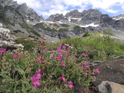
As we continue past Monte Cristo about 4 miles in, there are some steep, rough rock scrambles which turn into a smooth, steep incline until you arrive at the basin where the way levels out slightly. There are some old gold and silver-lead mines that have been blasted shut and some campsites scattered around the basin. There is a lot of exploring to do in the basin and it is a beautiful area.
WTA Pro Tip: Be sure to fill up water before you leave! The water below and at Monte Cristo is contaminated with Arsenic exposed during early mining in the area, so the first water source is a stream about a mile beyond the Monte Cristo Townsite. However, if you’re concerned about it, just plan to pack in all the water you’ll need, to be on the safe side.
Northwest Forest Pass required.
Gia map https://www.gaiagps.com/map/?loc=13.4/-121.3697/47.9884&trackId=1f0f836a-7539-45eb-8b39-93de0bbd8a80
WTA- Glacier Basin — Washington Trails Association (wta.org) . We will go a little further to add 0.6 miles and elevation.
Monte Cristo, Glacier Basin, Silver Lake & Twin Lakes
-
Green Trails Monte Cristo No. 143
Green Trails Sloan Peak No. 111
Green Trails Mountain Loop Highway No. 111SX - See full route/place details.
Required Equipment
Ten Essential Systems
- Navigation (map & compass)
- Sun protection (sunglasses & sunscreen)
- Insulation (extra clothing)
- Illumination (headlamp/flashlight)
- First-aid supplies
- Fire (waterproof matches/lighter/candle)
- Repair kit and tools
- Nutrition (extra food)
- Hydration (extra water)
- Emergency shelter (tent/plastic tube tent/garbage bag)
- Pack in all the water you’ll need, do not plan to filter on the hike.
