Field trip: Conditioning Hiking Series
CHS 1 Hike - Navaho Pass
Go Getter CHS1 hike for those who want to challenge themselves this month!
- Sat, Jun 8, 2019
- Seattle Hiking Committee
- Day Hiking
- Adults
- Strenuous
- Challenging
- Mileage: 11.6 mi
- Elevation Gain: 3,000 ft
- High Point Elevation: 6,000 ft
- Pace: 1.5-2.0 mph
- FULL, 1 on waitlist (11 capacity)
- Cancellation & Refund Policy
Planning on meeting at the Tibbets Valley Park & Ride (exit 15 off of I-90) leaving at 6:30 am for an approximate two hour drive via I-90 to the trailhead with an outhouse style toilet. A quick restroom break in Cle Elum might be preferred by some. A post hike meal at Beau's in Cle Elum is planned.
No snow when we scouted it on Wednesday 5/29 and Thursday 5/30. The route has a pretty consistent climb of about 500 feet/mile. I used poles on the ascent but only on one wide stream crossing coming down. Patti and I took 3.5 hours up and 2.25 hours down, including breaks with about 40 minutes at the pass for lunch.
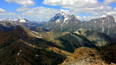
A Green Trails 208SX map includes the route as well as different peaks visible on the hike.
Navaho Pass & Peak
-
Green Trails Alpine Lakes East (Stuart Range) No. 208SX
Green Trails Mt Stuart No. 209
USGS Red Top Mtn
USGS Enchantment Lakes - See full route/place details.
Required Equipment
Ten Essential Systems
- Navigation (map & compass)
- Sun protection (sunglasses & sunscreen)
- Insulation (extra clothing)
- Illumination (headlamp/flashlight)
- First-aid supplies
- Fire (waterproof matches/lighter/candle)
- Repair kit and tools
- Nutrition (extra food)
- Hydration (extra water)
- Emergency shelter (tent/plastic tube tent/garbage bag)

