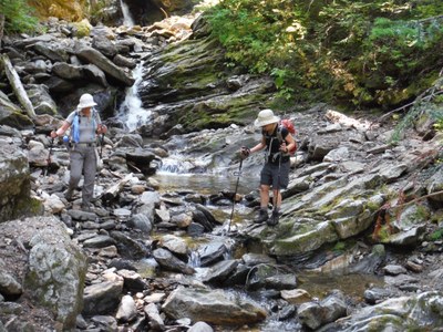
Field trip: Conditioning Hiking Series
CHS 1 Hike - Middle Fork Snoqualmie River
Hike to Rock Creek Falls. CHS hike led at a CHS 1 pace (1.5-2.0 mph)
- Tue, Jul 5, 2022
- Seattle Hiking Committee
- Day Hiking
- Adults
- Moderate
- Moderate
- Mileage: 11.0 mi
- Elevation Gain: 2,200 ft
- Pace: 1.5-2 mph or whatever is comfortable for the group
- 4 (10 capacity)
- FULL (2 capacity)
- Cancellation & Refund Policy
Meet at 7 am. at the Safeway in North Bend. Plan to arrive by 6:45 so we can be ready to leave by 6:45. We are hiking to Rock Creek Falls. There is not yet a description of the hike among the Mountaineer routes. See wta.org for the route description. We go by car about 6 miles up a rough gravel road and park in the Dingford Creek parking area. The road requires a high-clearance vehicle. Our Subaru Outback can fit 5, including us. We will need 1 or 2 hikers who can drive a pot-holed road to get us all to the trailhead. Please email me to let me know if you have a high clearance vehicle and how many riders you can take or if you need a ride from North Bend.
See the Rock Creek Falls route description on wta.org.
Bring poles if you have them. The trail might be muddy. Rocky in places, too. There are several stream crossing, so prepare for wet feet.
Middle Fork Snoqualmie River
-
Green Trails Skykomish No. 175
Trails Illustrated Alpine Lakes Wilderness
Green Trails Mt Si No. 174
Green Trails Stevens Pass No. 176
Green Trails Snoqualmie Pass No. 207
Green Trails Middle Fork Snoqualmie No. 174SX
Alpine Lakes Wilderness (ALPS) - See full route/place details.
Required Equipment
Ten Essential Systems
- Navigation (map & compass)
- Sun protection (sunglasses & sunscreen)
- Insulation (extra clothing)
- Illumination (headlamp/flashlight)
- First-aid supplies
- Fire (waterproof matches/lighter/candle)
- Repair kit and tools
- Nutrition (extra food)
- Hydration (extra water)
- Emergency shelter (tent/plastic tube tent/garbage bag)
