Field trip: GoHike: Beginner Hiking Course
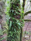
April Hikes: 2.5 - 5 miles, 250 - 1,000 feet gain - Licorice Fern Trail
Join us for this short easy hike on the south spur of Cougar Mountain Regional Wildland Park. It ends at Indian Trail and more hiking in the park. This hike can apply toward your GoHike Graduation!
- Sun, Apr 11, 2021
- Foothills Hiking Committee
- Day Hiking
- Adults
- Easy
- For Beginners (Getting Started Series)
- Mileage: 4.0 mi
- Elevation Gain: 400 ft
- Pace: 1.5 mph
- FULL, 1 on waitlist (7 capacity)
- Cancellation & Refund Policy
Meet at 9AM at the trailhead. Google map location https://goo.gl/maps/epvLUnUz9ftj8TFdA.
To reach the trailhead, take I-90 East to exit 15 from Bellevue/Seattle and make a right onto 17th Ave, which later becomes Renton/Issaquah Road. Drive for about four miles, then turn right onto SE May Valley Rd. Shortly after, make a sharp right onto SE 112th St. This road soon becomes 169th Ave SE as it turns left. The trailhead will be on that curve, on your right hand side--look for the hiker sign. Park along 169th Ave.
Or, from I-405, exit onto Coal Creek Pkwy. Head south to May Valley Rd. Turn left and continue 2.3 miles, merge onto SE 112th St, then turn left onto 169th Ave SE.
Note: As you enter the trail, you will see three potential routes: one paved on the left, one gravel straight ahead, and a grassy one on the right. Continue on the gravel trail, and you will soon find a second hiker sign.
We'll wander approx 4 miles and 400 feet of elevation gain through the lovely forest of Cougar Mountain Regional Wildlife Park.
We will follow The Mountaineers phase 2 Covid-19 protocols and every participant will be asked to agree to the Covid-19 Code of Conduct in order to register.
Required Equipment
A small part of the trail is narrow, poles might be helpful for those who would like a little more security in balance.
