West Tiger Mountain 1-2-3
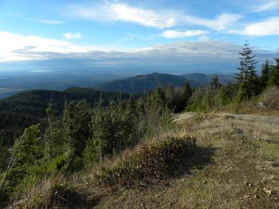
Hike to all of the West Tiger summits or hike any two of them! It's 10 miles or more and 2,800 feet of elevation gain in a popular forest in the I-90 corridor. Enjoy views of the Issaquah lowlands from all of these summits.
getting there
High Point Trailhead
Take Exit 20 (High Point) off of I-90, a few miles east of Issaquah and turn south on 270th Ave SE. Just a few yards south of I-90, turn right onto SE 79th St and continue west. The pavement ends in 0.4 miles where a gate is open each day from dawn until dusk. Continue through the gate and park in the lot of the High Point Trailhead. If you arrive before dawn or plan to come out after dusk, park on the road east of the gate.
High Point Pond
Take Exit 20 (High Point) off of I-90, a few miles east of Issaquah and turn south on 270th Ave SE. Then take an immediate right (west) onto SE 79th Street and park along the street. Walk east on 79th St to the white gate that crosses the street. This is a good meeting place. From the gate walk ~0.25 mile east on pavement to the High Point Trailhead and High Point Pond.
on the trail
High Point Trailhead
Follow the West Tiger No. 3 Trail from the trailhead to the summit of West Tiger 3 and then on to the West Tiger 2 and West Tiger 1. Or visa versa depending on where you parked. Other trails intersect this one, so you can vary your trip on the ascent or return as desired. You can also make one big loop trip using the West Tiger No. 3 and West Tiger No. 1 Trails.
INFORMATION FOR LEADERS
Permits
- Permits are required in this area for all fee-based (course-related) activities, regardless of group size. Leaders may list trips at this route/place with the understanding that they need to verify that a permit has been obtained before running the trip (if required as outlined above). Permit applications are submitted to WA Department of Natural Resources annually in December. Please contact info@mountaineers.org with any additional questions. More details about permitting on WA DNR land as it applies to Mountaineers trips, as well as our current year Land Use License, can be found here.
- Suitable Activities: Day Hiking, Trail Running
- Seasons: Year-round
- Weather: View weather forecast
- Difficulty: Strenuous
- Length: 10.0 mi
- Elevation Gain: 2,800 ft
- 2,948 ft
- Land Manager: Tiger Mountain NRCA & State Forest
- Parking Permit Required: Discover Pass
- Recommended Party Size: 12
- Maximum Party Size: 12
- Maximum Route/Place Capacity: 12
- Green Trails Tiger Mtn No. 204S
This is a list of titles that represent the variations of trips you can take at this route/place. This includes side trips, extensions and peak combinations. Not seeing a title that fits your trip? Log in and send us updates, images, or resources.
- West Tiger Mountain 1 & 2
- West Tiger Mountain 1 & 3
- West Tiger Mountain 2 & 3
- West Tiger Mountain 1, 2 & 3
- West Tiger Mountain No. 2
There are no resources for this route/place. Log in and send us updates, images, or resources.
