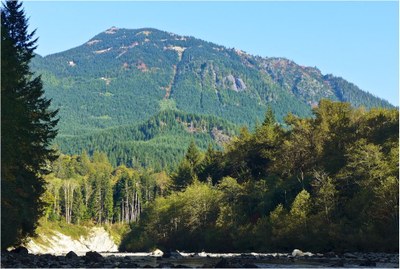
Bessemer & Moolock Mountains
A nice winter scramble or long snowshoe trip to high points on the ridge that extends from Mount Si, Teneriffe Mountain, Green Mountain in the Middle Fork Snoqualmie River Valley. Both routes are mostly on logging roads of which the upper sections are snow covered in the winter. Each route is 13+ miles round trip and 4,000+ feet of elevation gain.
getting there
From I-90 take Exit 34 near North Bend and head north on SE Edgewick Rd. Turn right onto SE Middle Fork Rd and follow it to where the pavement ends, the Mailbox Peak trailhead. Continue on for ~4 miles to the Bessemer CCC Road-Trail Trailhead.
route
South Bessemer Mountain (5,028 ft)
Follow the Bessemer CCC Road-Trail to the summit of South Bessemer Mountain. It's 13.6 miles round trip with 4,097 feet of elevation gain.
Moolock Mountain (4,965 ft)
Follow the Bessemer CCC Road-Trail to the saddle between Moolock and South Bessemer Mountain. Turn left and follow 4WD road to the east ridge of Moolock. Ascend the east ridge to the summit. It's 13.2 miles round trip with 4,343 feet of elevation gain.
Bessemer-Moolock Saddle (4,000 ft)
10 miles round trip, 3,100 feet of elevation gain
Follow the Bessemer CCC Road-Trail to the saddle between Moolock and South Bessemer Mountain. The route crosses the creek three times and the waterfalls at the crossings are quite pretty. There are views to the south including Mount Rainier and all of the peaks between the Middlefork Snoqualmie River Valley and I-90. To the north is a view of Hancock's Comb, a very interesting structure.
Bessemer Mountain (5,167 ft)
Also known as North Bessemer Mountain, this is the true summit. There are two possible routes to the summit.
Bessemer Road: Walk the road ~6 miles to the spur road below South Bessemer. At the end of the spur road, ascend to the ridge at ~4,800 ft, where there is a faint trail. Look for the talus field in the distance, and travel to and traverse across. Then descend another talus field for ~200 feet. From there traverse a field of ferns, descending down to ~4,500 ft. Look for a suitable spot to descend the ridge—straight down about 80 feet. Aim for the talus field in the distance, choosing the best way through the brush. At the talus field, head up to ~4,700 ft, then make a sharp right up onto some slabs into the next gully. This gully is slabby & mossy. Look for a way to exit on your left, a tree with slings. After reaching the tree, continue up to the ridge and start heading towards the summit. Traverse left below the ridge until forced to climb to the ridge. The ridge is airy & exposed in places. Belay at the base of the summit block. Head up and then left towards the summit, ~20 m of exposed but easy Class 5.
Southeast Ridge: It is possible to directly take the SE Ridge to 4,500 ft, however, there are difficulties on the the ridge that will occasionally need to be bypassed (mostly on the left). From ~4,500 ft, descend ~80 feet through steep brush and traverse until reaching a gully that leads to the summit ridge. The ridge is narrow and may need to be protected, and the summit block is a short (~40 feet), low Class 5 rock climb.
notes
- There is very little avalanche danger and there are no boulder fields (which can be aggravating and dangerous when there is not enough snow to fill in the gaps between them).
Information for leaders
Permits
As of 2017, the Snoqualmie Ranger District considers Mountaineers trips and courses to be "nominal use". Leaders should print and copy this designation letter to show rangers they may see on trail or carry a digital copy on their phone.
- Suitable Activities: Scrambling, Snowshoeing, Day Hiking
- Snowshoeing Category: Intermediate
- Seasons: Year-round
- Weather: View weather forecast
- View avalanche forecast.
- Difficulty: Very Strenuous, Winter Scramble
- Length: 13.6 mi
- Elevation Gain: 4,097 ft
- 5,028 ft
-
Land Manager:
Mount Baker-Snoqualmie National Forest
Alpine Lakes Wilderness, Snoqualmie Ranger District (MBSNF)
- Parking Permit Required: Discover Pass
- Recommended Party Size: 12
- Maximum Party Size: 12
- Maximum Route/Place Capacity: 12
- Green Trails Mount Si NRCA No. 206S
- USGS Mt Si
- USGS Lake Phillipa
This is a list of titles that represent the variations of trips you can take at this route/place. This includes side trips, extensions and peak combinations. Not seeing a title that fits your trip? Log in and send us updates, images, or resources.
- South Bessemer & Moolock Mountains
- South Bessemer Mountain
- Moolock Mountain
- Bessemer Mountain
- North Bessemer Mountain
- Bessemer-Moolock Saddle
There are no resources for this route/place. Log in and send us updates, images, or resources.
