Rich Passage
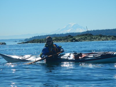
Sea kayak to Fort Ward and the Orchard Rocks Conservation Area with abundant sea life, a salmon farm, and Manchester State Park. With a big tide swing, it's a nice ride!
Launch Points
- Evergreen Rotary Park. There is usually plenty of parking unless it's a very busy time of day. Launching about two hours before SBF (Slack Before Flood) at Rich Passage off Pleasant Beach station, will put you at Orchard Rocks near slack.
- Illahee State Park boat ramp. Restrooms are available in the state park.
- Manchester State Park.
on the water
Ride the ebb out to Fort Ward on Bainbridge Island. Land at the boat ramp (toilets, picnic tables, no water) or paddle ~0.3 nm to the water trails site (toilets, water, camping, picnic table) which is next to the old barracks building. Paddle south to Orchard Rocks Conservation Area to observe sea life. Circumnavigate the adjacent salmon farm. Manchester State Park is another stop-over (or launch point) while you wait for the flood to build. Take out on the slab-rock bank to the left of the mud flat with as little as -2.0 ft tide to avoid the mud flat. Toilets, picnic tables, and water are available, but water trails campsites are not favorites.
Notes
- Make a lap around the Turner Joy museum battleship which is moored at the Bremerton Marina before taking out at Evergreen.
- For trips to Blake Island, see our Blake Island route/place.
information for leaders
Scheduling & Permits
- If you are scheduling this as a non-course related activity, please limit your group size to the recommended party size. The maximum party size is for use by course field trips only, and includes both students and instructors. Group size maximums do not reflect how course field trips are run (in smaller groups of students and instructors), but allow for course leaders to register the course in our system.
- The Mountaineers has a commercial use permit with Washington State Parks for all free and fee-based outings at state parks. Leaders should carry a print or digital copy of our commercial use permit to show rangers they may encounter.
- Suitable Activities: Sea Kayaking
- Seasons: Year-round
- Weather: View weather forecast
- Difficulty: Sea Kayak IV
- Length: 12.0 nm
- Land Manager: City of Bremerton Parks System
- Parking Permit Required: None
- Recommended Party Size: 12
- Maximum Party Size: 32
- Maximum Route/Place Capacity: 32
- MapTech Puget Sound Chart No. 100
- Sea Trails Seattle, Bainbridge Island, Bremerton and Liberty Bay WA202
- NOAA Puget Sound: Seattle to Bremerton No. 18449
This is a list of titles that represent the variations of trips you can take at this route/place. This includes side trips, extensions and peak combinations. Not seeing a title that fits your trip? Log in and send us updates, images, or resources.
- Bremerton to Bainbridge Island
- Bremerton to Orchard Rocks
- Illahee State Park to Bainbridge Island
- Rich Passage: Bremerton to Bainbridge Island
- Rich Passage: Bremerton to Orchard Rocks
- Rich Passage: Illahee State Park to Bainbridge Island
There are no resources for this route/place. Log in and send us updates, images, or resources.
