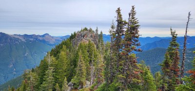
Florence Peak
Florence Peak is a moderately strenuous but not particularly challenging rock scramble, with over 3,500 feet of elevation gain in less than 4 miles. It is a popular trip in Mount Rainier National Park, with good views of "the Mountain" and other Carbon River area peaks.
ASCENT ROUTE
(From 100 Peaks around Mt Rainier) South of the old ranger station is a 0.3 mi nature walk. Head onto the walk and take the right loop. In about 0.1 mile, the nature walk continues to the left and you will find a trail leading uphill. A post with arrows indicating up and down is at this location as of 2012. (Obviously, you should follow the “up” path.) Follow the trail (this trail is part of the park’s boundary trail system). Though officially not maintained, the trail is in good shape and has been considerably upgraded to an elevation of 2,300 ft (as of 2012). The trail is easily followed until the saddle at 4,500 ft on Alki Crest ridge. From the saddle, leave the trail and head southeast along the ridge (stay to the right of rocky outcroppings). There is an easy-to-follow footpath in summer.
- Suitable Activities: Scrambling
- Seasons: April, May, June, July, August, September, October
- Weather: View weather forecast
- Difficulty: Strenuous 3, Technical 2
- Length: 8.0 mi
- Elevation Gain: 3,500 ft
- 5,501 ft
-
Land Manager:
Mount Rainier National Park
Mount Rainier Wilderness
- Parking Permit Required: National Park Entrance Fee
- Recommended Party Size: 12
- Maximum Party Size: 12
- Maximum Route/Place Capacity: 12
- USGS Golden Lakes
There are no resources for this route/place. Log in and send us updates, images, or resources.
