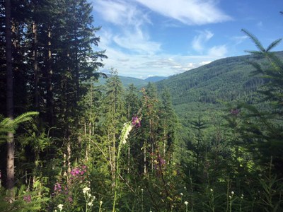
East Tiger Mountain
East Tiger Mountain is a moderate, 8.4 mile loop day hike with 1,600 feet of elevation gain. The trail goes through old forests, over over creeks and up to the East Tiger Mountain summit viewpoint. It's the highest of the Tiger Mountain summits!
getting there
Drive SR-18 to the Tiger Summit Trailhead, about 4 miles from Exit 25 off of I-90 (1,480 ft).
on the trail
Tiger Summit Trailhead, SR 18
From the Tiger Summit Trailhead on SR 18, follow the Main Tiger Mountain Road (Road 4000) to the East Tiger Summit Road that loops to the East Tiger Mountain summit. Continue on to Crossover Road, turning right onto it. Then turn left in 0.4 mile back onto Main Tiger Mountain Road and continue hiking back to the trailhead.
High Point Trailhead, I-90/Exit 20
Walk down gated road off of Exit 20 to the High Point Pond Trailhead. Hike up to Dwight's Way and turn left. Hike 0.7 miles to West Tiger 1 Trail and turn right. Hike 0.5 miles and meet up with Bootleg Trail and continue up 0.1 miles to a fork. Stay to the left on the Bootleg Trail, cross East Fork Issaquah Creek, and then come to a flat open area where the trail connects to a road. Before the trail turns into a road, look for the trail on the right and re-enter the woods. Hike up to a junction with the East Tiger Trail and turn left. Hike 1.1 miles, crossing a road that isn't on the map about halfway down the trail. Reach the Preston Railroad Grade and you have two options:
- Option 1: Look for the old trail obscured by branches on the other side of the Preston Railroad Grade. Hike 0.5 miles up to another road, and go right for 0.2 miles to the summit. This is the shortest and more direct route, but steeper with a lot of logs and branches on the trail in an attempt to hide it.
- Option 2: Turn right on the Preston Railroad Grade and hike to the new trail on the left that goes up to the top of East Tiger. This route adds about an extra mile to the hike but the trail is not as steep and well-maintained.
Notes
- East Tiger Mountain has several steep trails which allow for both hikers and mountain bikes. There may be minimal reaction time to alert a group of bikers heading down. Do beware and exercise caution.
INFORMATION FOR LEADERS
- Permits are required in this area for all fee-based (course-related) activities, regardless of group size. Leaders may list trips at this route/place with the understanding that they need to verify that a permit has been obtained before running the trip (if required as outlined above). Permit applications are submitted to WA Department of Natural Resources annually in December. Please contact info@mountaineers.org with any additional questions. More details about permitting on WA DNR land as it applies to Mountaineers trips, as well as our current year Land Use License, can be found here.
- Suitable Activities: Bikepacking, Day Hiking, Trail Running
- Seasons: Year-round
- Weather: View weather forecast
- Difficulty: Moderate, Bikepacking MTB III, Bikepacking MTB IV
- Length: 8.5 mi
- Elevation Gain: 1,600 ft
- 3,004 ft
- Land Manager: Tiger Mountain and Raging River State Forests
- Parking Permit Required: Discover Pass
- Recommended Party Size: 12
- Maximum Party Size: 12
- Maximum Route/Place Capacity: 12
- Green Trails Tiger Mtn No. 204S
There are no resources for this route/place. Log in and send us updates, images, or resources.
