Trip
Backpack - Entiat River Meadows & High Country
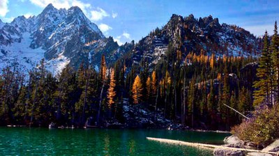
We will hike along the Entiat River to it's source near the Entiat Glacier possibly visiting Larch Lakes or Myrtle Lake in route back This route is to replace the Imnaha River on the East side of the Wallowas due to snow.
- Fri, Jun 17, 2022 — Mon, Jun 20, 2022
- Olympia Hiking & Backpacking Committee
- Backpacking
- Adults
- Strenuous
- Challenging
- Mileage: 32.0 mi
- Elevation Gain: 6,900 ft
- High Point Elevation: 5,600 ft
- Pace: 2mph
- 2 (4 capacity)
- FULL (2 capacity)
- Cancellation & Refund Policy
I enjoy hiking in the rain but will cancel the trip if it is likely to rain the entire time given the distance and missing out on the views.
** LEADERS PERMISSION REQUIRED **
We will hike at a moderate 2 mph pace, taking frequent breaks. We will stop for an extended lunch (~20 minutes).
There may not be an option for hanging food. I plan to bring my Ursack.
This trail does not get much traffic.
Goals, Expectations, and Style: My goals are always to stay safe, have fun, and do my best to help everyone feel welcome and included, while keeping a sense of interdependence and finding some wild and free moments. My expectations are that everyone will read all the information carefully, be truthful about their ability and experience level, communicate needs proactively, always stay with at least one other person and regroup at junctions, will work as a team to support each other, leave camp at the agreed on time and get to camp at a reasonable time. Everyone will do their best and try to be “all in” during the trip. Everyone will have the needed supplies for cooking, food storage, sleeping, and enough food and water for the trip. My style is to take breaks for swimming, snacks, and a longer lunch, to keep a steady pace around 2mph sometimes a bit slower uphill, to have good conversation with everyone in the group and have time together at camp around mealtime. I sometimes like to have an early morning coffee “sit spot” but enjoy having social time in the evening. I love exploring around camp and seeing “all the things”. I enjoy high places and don’t mind exposure but will not hike through high exposed areas in very rainy, snowy, or icy conditions.
This trail goes through burned areas and we are likely to encounter many down trees this time of year.
Entiat River Meadows & High Country
-
Green Trails Lucerne No. 114
Green Trails Holden No. 113 - See full route/place details.
Required Equipment
The Ten Essentials plus overnight gear which may include:
- Tent with footprint/ground tarp
- Stove and fuel
- Sleeping bag
- Sleeping pad
- Water filter
- Ursack or other food storage method.
- Cooking pot/pan with plate and utensils
- Toilet paper and shovel or blue bag to deal with waste
- I recommend hiking poles and possibly will bring microspikes if there is a chance of snow still on the trail.
