Trip
Backcountry Trail Run - Scorpion Mountain
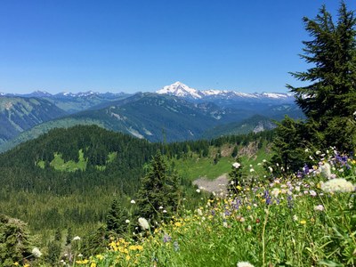
Wildflower trail run- climb up for great views.
- Fri, Aug 13, 2021
- Foothills Trail Running Committee
- Trail Running
- Adults
- Moderate/Strenuous
- Challenging
- Mileage: 10.0 mi
- Elevation Gain: 2,650 ft
- Pace: 3-5mph
- 4 (4 capacity)
- 2 (2 capacity)
- Cancellation & Refund Policy
8:00am at the trailhead. Supposedly no parking pass is required at this trailhead but this general area is covered by the Northwest Forest Pass or equivalent (America the Beautiful pass).
- GPS coordinates: 47.7964971, -121.2624516.
- Google map: https://goo.gl/maps/YS9yB92qM52ArBcr6
-
WTA.org driving directions: From Monroe, head east on US-2 for 33 miles to the town of Skykomish. Continue less than a mile, then turn left on Beckler Road (Forest Road 65). Drive 6.9 miles to the end of the pavement. Subsequently on GRAVEL/DIRT FOREST SERVICE ROADS WHICH MIGHT BE ROUGH: At the four-way intersection, make a sharp right turn onto NF-6520. In 2.7 miles stay left at an unmarked junction, continuing another 4.1 miles to the trailhead at road’s end. There is room for 6 to 8 vehicles, and some shoulder parking along the road. There are no amenities.
This route has some flat stretches mixed in with steeper climbs. We'll descend to Joan Lake.
Smoky air, foul weather, or public health emergency most likely will cancel this trip.
Note: If you don't have the backcountry trail running badge but would like to take part in this trip please email trip leader.
Scorpion Mountain
-
USGS Monte Cristo
USGS Bench Mark Mtn
Green Trails Monte Cristo No. 143
Green Trails Benchmark Mtn No. 144 - See full route/place details.
Required Equipment
- The Ten Essentials
- Sturdy running shoes
- Pack to carry food, water, extra layer, first aid, personal items, hat, sunglasses, etc.
- Any items mandated by the club's COVID-19 guidance and/or public health guidance for this county
- Trail can be buggy according to trip reports so consider bug repellent
