Trip
Backcountry Ski/Snowboard - Mount McCausland
Moderate paced tour for intermediate sliders to Mt McCausland which is east of Stevens Pass. The approximate trail head to destination evaluation gain is 2600 feet. The round trip distance is approximately 10 miles.
- Sun, Feb 23, 2020
- Foothills Backcountry Skiing Committee
- Backcountry Skiing
- Retired Rovers, Adults, Singles
- Moderate/Strenuous
- Moderate
- Mileage: 10.0 mi
- Elevation Gain: 2,600 ft
- 6 (5 capacity)
- Cancellation & Refund Policy
Meet at the Smithbrook Road shoulder parking area.
Drive about 6 miles east of Stevens Pass to the Stevens Pass Nordic Area, turn left on the road that cuts across the median and leads to the westbound lanes of Highway 2. Now drive about 1.5 miles west and park on the north side of Highway 2 at milepost 68.9 about 0.2 miles before the Smithbrook Road. The shoulder is plowed extra-wide here for winter recreationalists using the Smithbrook Road.
Have your climbing skins on and be ready to start the tour at 8:30 am.
Car Pooling
To arrange a car pool, select the Roster tab in the trip description, and then the blue Email Roster button to get the car pool preferences and email addresses of the trip participants.
This will be a moderate paced tour. It is the responsibility of each participant to stay within voice distance of the participant behind them.
Enclosed are links for a map, profile, segment description of the route and a ski trip and avalanche rescue checklist. Here are links for possible descent routes: Dow Lake, North Bowl, North Ridge and the route out.
We will return to the trail head prior to 5:00 pm.
The AIARE field book or the ski trip and avalanche rescue checklist are MANDATORY equipment to participate on the trip. You will not participate in the trip without them.
You must complete the appropriate sections of the AIARE field book or the following sections of the trip checklist PRIOR to arriving at the trail head: Weather, Avalanche Problem and Avalanche Advisory Key Messages. Use the enclosed segment description of the route for the travel plan and identify FOUR field observation locations where observations will be recorded. We will use the AIARE Avalanches and Observations when performing our observations so bring a copy of it with you.
You will be using the map and the travel plan to lead the navigation to and from our destination.
Please check your email after 9 pm on the day before the trip, and in the morning before you leave for route changes due to avalanche and weather conditions. If you do not receive an email at either of these times, the route has not changed.
The actual route will depend on snow, avalanche, weather conditions and participants’ abilities. If needed, an alternate, safer destination will be chosen by group consensus.
We will conduct a review of the day at the cars.
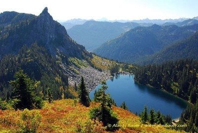
Mount McCausland
-
Green Trails Alpine Lakes West (Stevens Pass) No. 176S
Green Trails Benchmark Mtn No. 144
USGS Labyrinth Mtn - See full route/place details.
Required Equipment
- Boots, skis/snowboard, poles
- Climbing skins (or other method to travel uphill on snow)
- Avalanche shovel (metal blade)
- Avalanche beacon
- Avalanche probe
- AIARE field book or the ski trip and avalanche rescue checklist
