Trip Report
Day Hike - Shady Lane & Staircase Rapids
Late November hike near Lake Cushman along Shady Lane, Staircase, and then on up the North Fork Skokomish trail for a couple of miles. 9 miles/800 feet of elevation gain.
- Sun, Nov 20, 2022
- Day Hike - Shady Lane & Staircase Rapids
- Shady Lane & Staircase Rapids
- Day Hiking
- Successful
-

- Road rough but passable
-
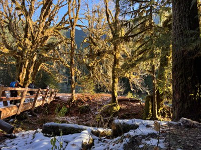
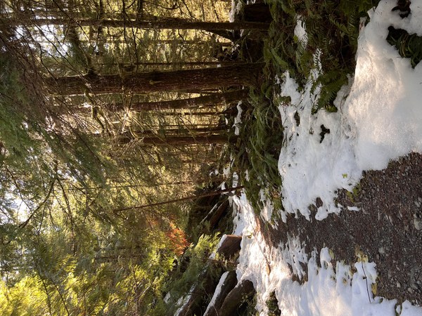
The trail had more snow on it than expected. Friends had hiked the Mount Rose Trail up to Horse Camp earlier this week and reported little/no snow, and its elevation is significantly higher than the Staircase area; similar reports from the Big Creek hike, also in this area. We had traction devices but never put them on because the snow/ice on the trail was sporadic; conditions were such that if the snow/ice covered a greater portion of the trail we would have used our micro-spikes. I would guess that about 10 to 15% of the trail had snow or ice on it. The most problematic areas were the few bridges we crossed that had compact snow/ice on them; hand rails were very helpful in crossing. Even though it was sunny with highs in the low 40's when we ended, there was very little melting. We started at the Shady Lane trailhead (near Copper Creek), hiked to the Staircase Rapids trail, hiked up-river to where we crossed the suspension bridge, and then turned left to hike upstream along the North Fork Skokomish River Trail to where it intersected with the Flapjacks Lake Trail where we sat on a log, ate lunch, and returned to the cars via the same route. There were a few trees down along the trail, but they were easily crossed.

After learning earlier this week that the road back into the Staircase area is closed through spring as is the campground, we met at Shady Lane Trailhead that is near the Copper Creek Trailhead. The road changes to gravel near the Mount Rose Trailhead and can have some rather large potholes and washboarding. My Subaru Forester was fine on the road today; we went slowly and dodged as many potholes as we could. The many shades of greens contrasted with the snow, blue skies, and always beautifully clear river to make for a beautiful hike. We met at 8:30 at the trailhead (no toilet facilities there) and were the first cars in the area. When we returned at 2:00 there were 5 cars total. We met another group who had parked at the gate where the road was gated (near the pay station) and they said walking the road was fine since it was closed and there were no cars on it. 9 miles/800 feet of elevation gain/5 hours.
 Becky Andrade